Library

Trees and tree canopy (a measurement which encompasses the layer of leaves, branches and stems of trees that shelter the ground when viewed from above) are increasingly recognized as key tools in achieving environmental, social, and economic resilience.

Documents

doc-urban-tree-canopy-assessments4084.pdf

Urban Tree Canopy Cover Assessment for the City of Chicopee
Tree canopy report
doc-urban-tree-canopy-assessments4084.pdf

doc-urban-tree-canopy-assessments4085.pdf

Urban Tree Canopy Cover Assessment for the Town of Agawam
Tree canopy report
doc-urban-tree-canopy-assessments4085.pdf

doc-urban-tree-canopy-assessments4086.pdf

Assessing Urban Tree Canopy Cover in the Merrick and Memorial Neighborhoods
Tree canopy report
doc-urban-tree-canopy-assessments4086.pdf

Draft FY 2021 CIP (Story Map and Document): 

Documents

2021 CIP Flyer (1).pdf

2021 CIP Flyer
2021 CIP Flyer
2021 CIP Flyer (1).pdf

PUBLIC PARTICIPATION NOTICE

Proposed Amendments to the FFY 2020 Transportation Improvement Program (TIP)

TIP is a Five-year schedule of priority highway, bridge, transit, and multimodal projects identified by year and location complete with funding source and cost.  The TIP is developed annually and is available for amendment and adjustment at any time.  Each program year of the TIP coincides with the Federal Fiscal Year calendar, October 1 through September 30.  

Documents

doc-2021-2025-transportation-improvement-program-tip4099.pdf

2021-2022 TIP Project Cost increases
November 2020

doc-2021-2025-transportation-improvement-program-tip4022.pdf

2021-2025 Document - Endorsed May 2020
Document May 2020

doc-2021-2025-transportation-improvement-program-tip4023.pdf

Transit Tables - May 26 2020
Transit Tables May 26 2020

doc-2021-2025-transportation-improvement-program-tip4024.PDF

Highway Tables - May 26 2020
Highway tables May 26 2020

doc-2021-2025-transportation-improvement-program-tip4002.pdf

Draft 2021-2025 TIP Document - April 28 2020
Document

doc-2021-2025-transportation-improvement-program-tip3999.pdf

Draft 2021 Transit TIP April 2020 - Tables
Transit tables 4/28/2020

doc-2021-2025-transportation-improvement-program-tip4003.pdf

Draft 2021-2025 TIP - Highway Tables April 28 2020
Highway Tables

doc-2021-2025-transportation-improvement-program-tip4004.pdf

2021-2025 TIP Development Schedule- April 28 2020
doc-2021-2025-transportation-improvement-program-tip4004.pdf

West Springfield is updating its Hazard Mitigation Plan with assistance from the Pioneer Valley Planning Commission and funding from the Federal Emergency Management Agency (FEMA) and the Massachusetts Emergency Management Agency (MEMA). 

Documents

doc-west-springfield-hazard-mitigation-plan3934.pdf

DRAFT West Springfield Hazard Mitigation Plan Update
Public draft of the 2020 West Springfield Hazard Mitigation Plan Update
doc-west-springfield-hazard-mitigation-plan3934.pdf

The Town of Longmeadow has completed an update of it's Open Space and Recreation Plan.

Documents

doc-longmeadow-open-space-and-recreation-plan-update4172.pdf

Longmeadow 2021-2028 Open Space and Recreation Plan
Final Longmeadow Open Space and Recreation Plan Update, 2021-2028
doc-longmeadow-open-space-and-recreation-plan-update4172.pdf

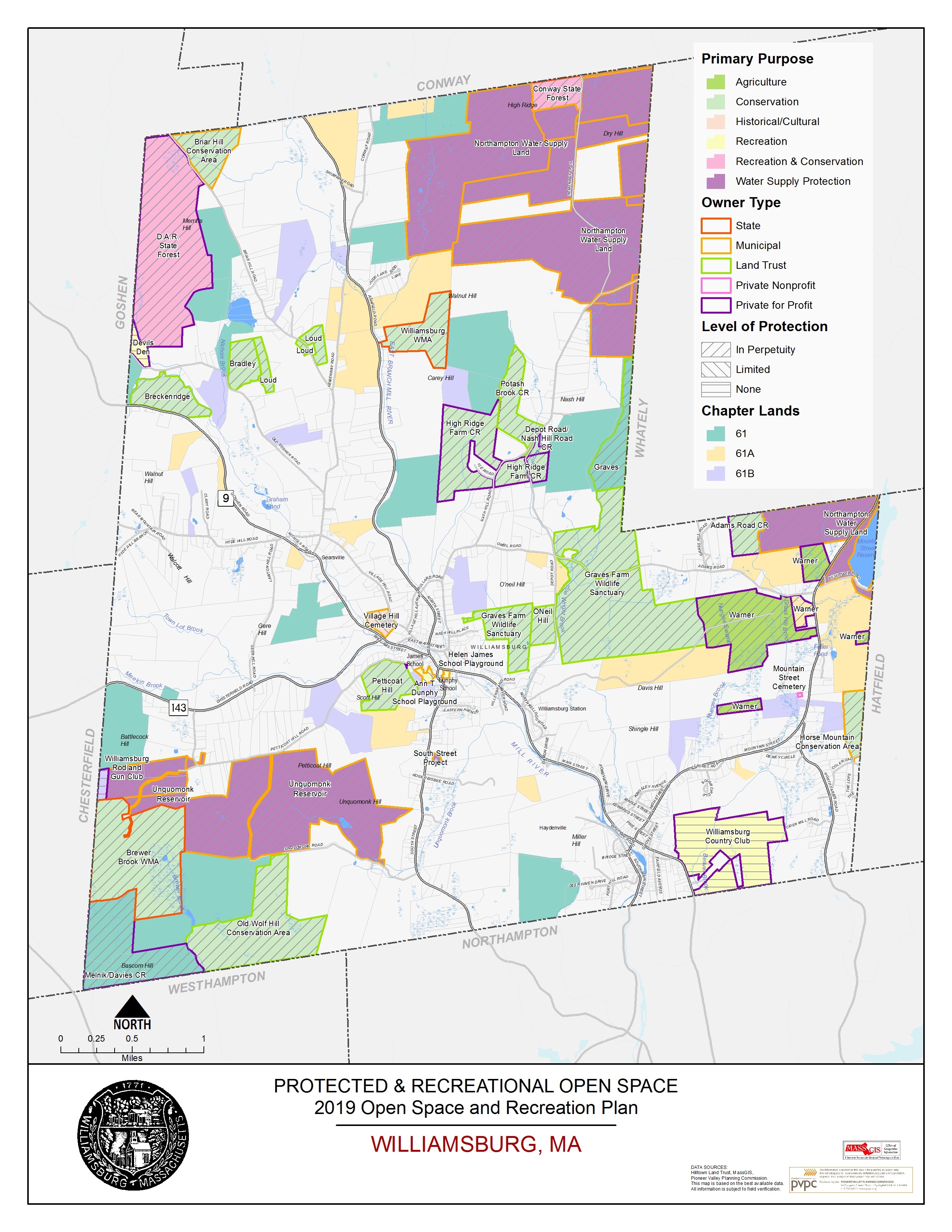
The Town of Williamsburg is undertaking a planning effort to develop an updated Williamsburg Open Space and Recreation Plan (OSRP), which was last completed in 2010.

Northampton has made impressive strides to address fair housing issues in recent years.

Documents

AI Final Northampton Oct 11.pdf

Unlocking Opportunity: An Assessment of Barriers to Fair Housing in Northampton
Northampton Fair Housing report
AI Final Northampton Oct 11.pdf

A Complete Street is a street designed to accomodate all users in a safe, convenient, and comfortable manner.

Documents

doc-city-springfield-pedestrian-and-bicycle-complete-streets-plan3891.pdf

City of Springfield Pedestrian and Bicycle Complete Streets Plan
Springfield's Complete's Streets Bike/Ped Plan
doc-city-springfield-pedestrian-and-bicycle-complete-streets-plan3891.pdf

Streets direct people; they movegoods; they accommodate cars,buses, and bicycles; they provide social connections, and ultimately they establish the
platform for the rest of the city to build upon.

Documents

doc-springfield-complete-streets3885.pdf

Springfield Complete Streets Implementation Guide

Pages

Search by Keyword

BMP
bus
CCC
CIC
CMP
CMS
CSA
GHG
GIS
GPS
HIA
IT
JLT
JTC
map
MPO
MPR
mvp
PMS
PPP
rfi
RFP
RFQ
RTP
SKC
TEC
TIP
WSU